


vtt 2eme

wimpy
User
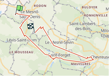

Length
19.1 km

Max alt
178 m

Uphill gradient
271 m
Km-Effort
23 km

Min alt
87 m

Downhill gradient
277 m
Boucle
No
Creation date :
2014-12-10 00:00:00.0
Updated on :
2014-12-10 00:00:00.0
--
Difficulty : Unknown

FREE GPS app for hiking
 SityTrail
IGN / Geographical institutes
SityTrail Plus
The world is yours!
About
Trail Other activity of 19.1 km to be discovered at Ile-de-France, Yvelines, Le Mesnil-Saint-Denis. This trail is proposed by wimpy.
Positioning
Country:
France
Region :
Ile-de-France
Department/Province :
Yvelines
Municipality :
Le Mesnil-Saint-Denis
Location:
Unknown
Start:(Dec)
Start:(UTM)
422388 ; 5399012 (31U) N.
Comments